blah blah blah
Monadnock Mountain
Length: 4.8 miles out-and-backDifficulty (click for info): Moderate
Elevation Gain: 2120 feet
Rating (click for info): 8/10
Elevation: 3137'
Prominence: 1522'
Driving Directions:
Trailhead and parking area are on Rt. 102 in Lemington, VT. Drive west on Rt. 26 (Bridge Street) from the center of Colebrook. Just before the bridge over the Connecticut River and the state line, turn left onto Bill Bromage Drive, turn right immediately, and look for a space to park around a large empty gravel lot running parallel to the main road. Click here for a Google map.
About the Hike:
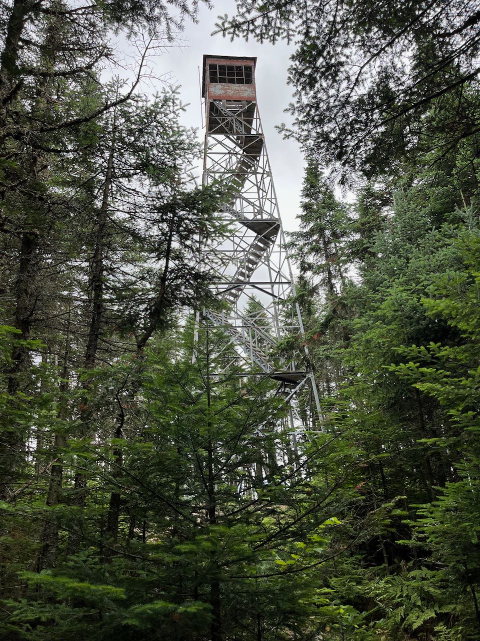
Monadnock is a name for mountains that stand completely alone. The monadnock everyone knows is the Mt. Monadnock in southwestern New Hampshire, but the second Monadnock Mountain is located in the Northern Kingdom of Vermont. Despite being across the state line, it has an association with Great North Woods hiking because of its looming presence over the town of Colebrook. Its nicely refurbished fire tower provides a stunning panorama of a region with not many maintained hiking trails. The hike to the top utilizes the old jeep road to the fire tower, as many tower trails do. This makes for a steady grind of a hike to surmount the respectable elevation difference from the Connecticut River to the summit. Difficulties with trailhead location has kept it from major notoriety, but it is easy enough to find if you know where to go.
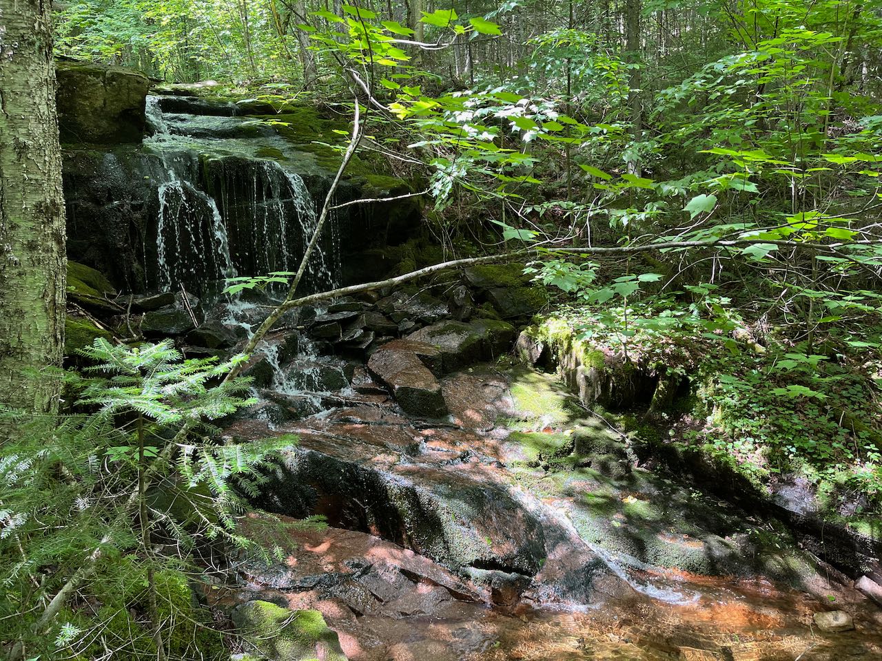
From the parking area, walk out to the main road and walk across the bridge. Turn left and walk past a small pull-off by the river (this is private property and parking here is not permitted). Look across the street to the white house (#6291 River Road). The house has a loop driveway with two entrances. Walk up to the left entrance and follow the edge of the trees between this house and the next one over. Keeping pets leashed in this area is mandatory. Staying as close to the trees as possible to respect the homeowners' privacy, walk along the edge of the lawn to the area behind the house, where you will see a clear road forking left into the woods. Follow this road as it crosses a wide and shallow brook and then transitions into a forest of tall pines. The trail, though unmarked, is a wide woods road with a clear foot track. 0.15 miles past the brook crossing, the road meanders up a grassy switchback and angles up the hillside at a gentle pace. In 0.3 miles, the trail swings left uphill and becomes steeper and rockier, soon passing where an older version of the trail came in from the right. A new arrow sign has been placed to divert away from this on the way back down. In another 0.15 miles, the trail approaches a pleasant brook and follows its bank for a distance. It edges along a little gorge, then passes by a small cascade. Some muddy ground spills over the road after this point and the route fades into just an average mountain footpath, now marked regularly with yellow wooden blazes. After 0.2 miles along the brook, the trail crosses over a mossy ledge in the bed on a long wooden bridge. The trail continues to follow it closely on the other side, climbing at an increasing grade through the open woods up the brook valley. Soon it pulls out of sight from the brook, but continues to parallel it. It climbs higher up, transitioning into darker evergreens while plodding over a stony surface. After a steady half mile ascent, the trail swings to the right, climbs 0.1 miles, then turns back to the left and weaves across more mellow terrain. It leads along a bit of a plateau for 0.35 miles in enchanting northern forest, then resumes climbing up the summit cone. The trail zig-zags upward through sparce conifers for 0.3 miles, leveling out and arriving at the summit.
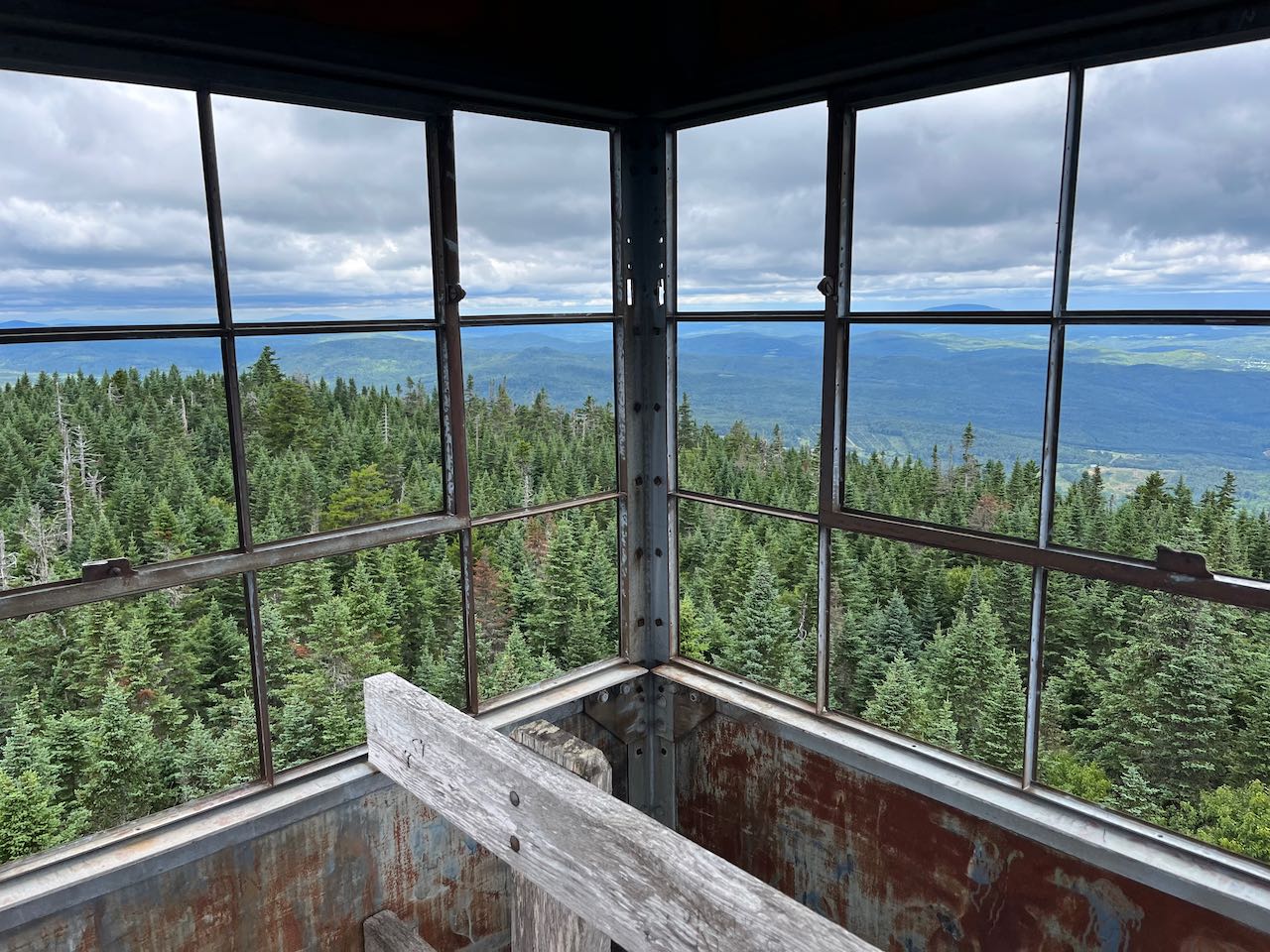
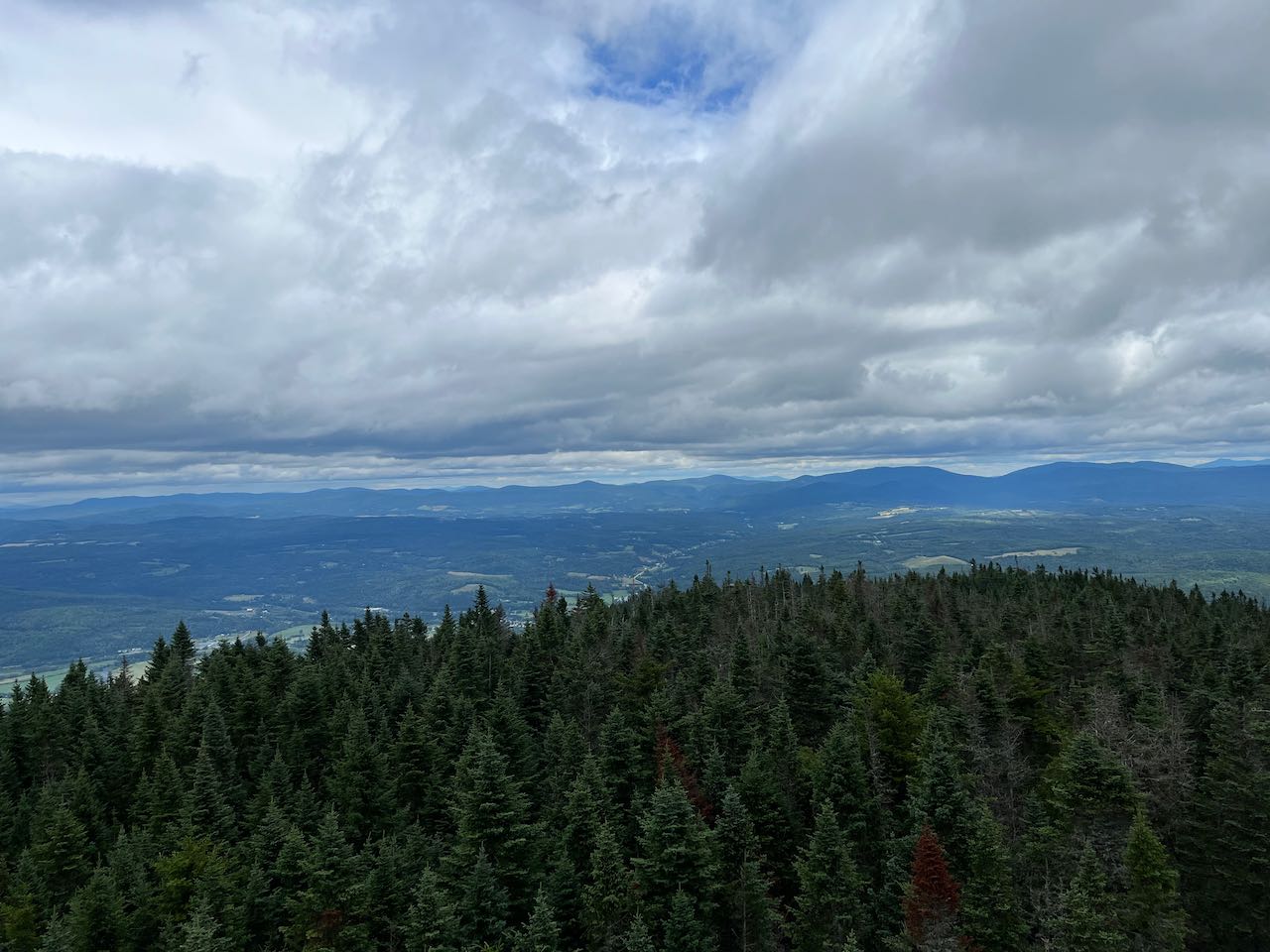
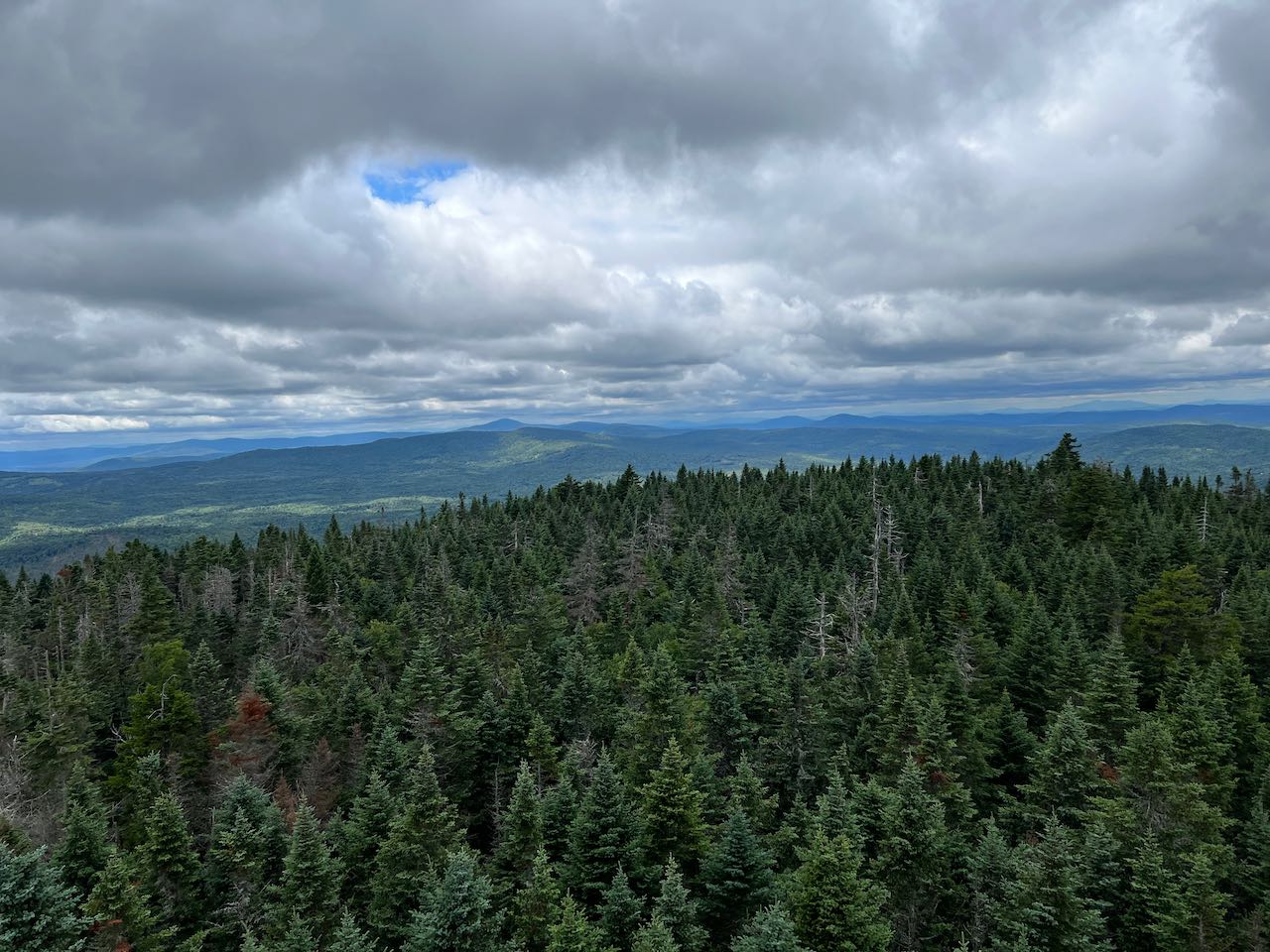
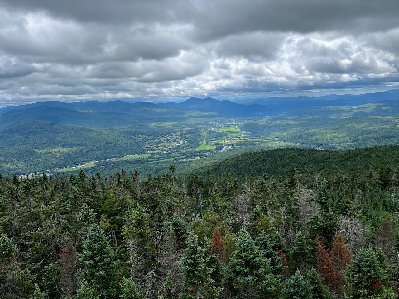
The tower looms high overhead the summit clearing. A sign designates the summit elevation, while beaten paths lead to a camp clearing and a stone chimney buried in dense brush. Nothing can be seen from the ground level, so you must climb the six flights of stairs into the enclosed tower cab, lifted 80 feet over the mountaintop. The windowpanes have been removed, so on breezy days, the draft pierces through the structure. Looking out the frame, to the north, the view gazes upslope over the infant Connecticut River Valley toward Canada, where another serious monadnock, Mont Megantic, is seen in the distance. Some of the Boundary Range is in view as well. Off to the northeast are some of the peaks in the vast logging wilderness, including Stub Hill, highpoint of the Connecticut Lakes Region, and Magalloway Mountain. Some peaks in Maine can be noticed in the distance. To the east, a long chain of rolling hills with obscure names leads to a prominent gash carved into the landscape; Dixville Notch. Route 26 can be seen pointing straight into it. In the distance lie Maine's Elephant and Old Blue Mountains. On the other side of the notch are the big mountains that house a huge wind farm - Dixville Peak and Mt. Kelsey. To the right of the turbines, you can see distant Mahoosuc 4000-footer Old Speck Mountain. The nearer peaks continue into the remote Nash Stream Forest, starting with Muise Mountain. Behind a warm and pastoral vista of open spaces and river lies the Stratford Range on the left, with Mt. Washington visible over the top, and disconnected Savage and Teapot Mountains on the right. On either side of these twin peaks, the view stretches south to the central White Mountains. The Southern Presidentials, the Willey Range, the Twin Range, and Mt. Carrigain are seen on the left side, while the Franconia Range, Kinsman Range, and Mt. Moosilauke are seen on the right. More to the southwest, the view crosses over into Vermont, where East Mountain is a prominent feature with its large crowning structure. Further over to the west, the spine of the Green Mountains stretches across the horizon from Camels Hump past Mt. Mansfield to the Jay Peaks. To the northwest are a multitude of unfamiliar summits in Quebec.
Printable directions page